Understanding the Atacama Desert: geography, climate, and unique features
The Atacama Desert in northern Chile is renowned as one of the driest places on earth, with an average annual rainfall of just 15 mm. This vast desert region stretches over 105,000 km², bordered by the Pacific Ocean and the Andes Mountains, creating a dramatic rain shadow effect. The desert’s arid climate, coupled with its high elevation—San Pedro de Atacama sits at 2,408 meters—results in extreme temperature variations between day and night.
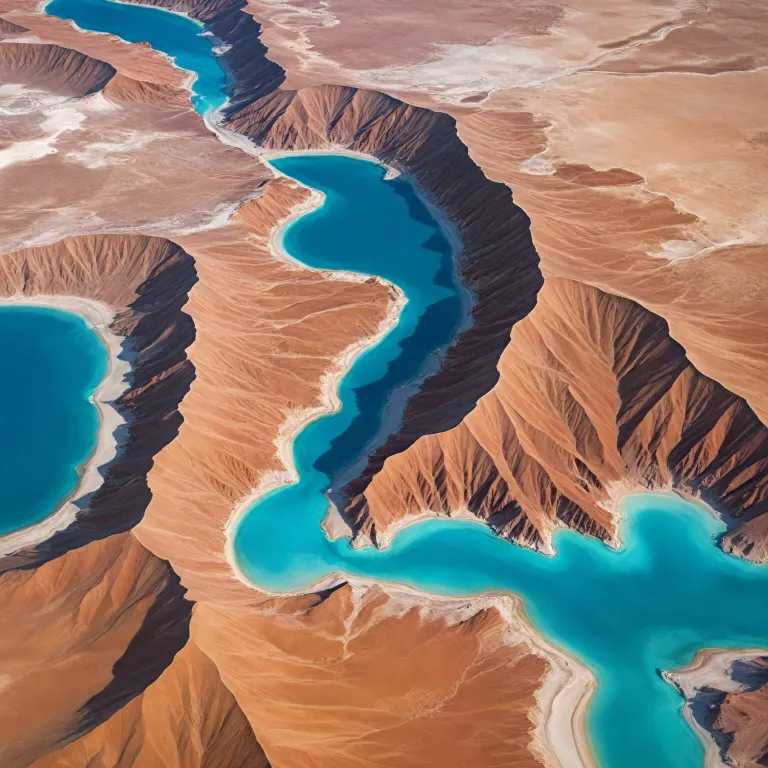
Travelers are drawn to the Atacama region for its otherworldly landscapes, including the expansive salt flats, volcanic peaks, and unique geological formations. The salt flat, known as the Salar de Atacama, is the largest in Chile and a key highlight for visitors. The desert’s clear skies and minimal light pollution have also made it a global center for astronomical research, with several world-class observatories dotting the landscape. The Atacama Desert Chile map is essential for navigating this vast and varied terrain, helping visitors locate key sites such as the Valle de la Luna, the Tara Salt Flats, and the Lascar Volcano.
San Pedro de Atacama serves as the main gateway to the desert, offering access to the region’s most iconic attractions. The town of San Pedro is an oasis in the heart of the desert, providing fresh water and a base for day trips to the surrounding salt flats, volcanoes, and valleys. The Atacama Desert Chile map is indispensable for planning routes, understanding distances, and ensuring a safe and enriching experience in this remarkable part of South America.
San Pedro de Atacama: the vibrant heart of the desert
San Pedro de Atacama is more than just a starting point; it is a vibrant town with deep historical roots and a unique cultural atmosphere. Nestled in the Atacama region, San Pedro is surrounded by the vast desert, salt flats, and volcanic landscapes that define northern Chile. The town’s adobe architecture and bustling markets reflect the traditions of the indigenous people who have inhabited the area since the pre-Columbian era.
Visitors will find that San Pedro de Atacama offers a range of accommodations, from premium hotels to eco-friendly lodges, catering to travelers seeking comfort and authenticity. The town’s central location makes it ideal for exploring the surrounding desert, with guided tours departing daily to sites such as the Valle de la Luna, the salt flats, and the Ojos del Salar. The Atacama Desert Chile map is a valuable tool for navigating these excursions, ensuring that travelers make the most of their time in the region.
For those interested in astronomy, San Pedro is home to several observatories that take advantage of the desert’s clear skies. The town’s proximity to the Lascar Volcano and the Tara Salt Flats provides opportunities for adventure and discovery. For more insights on planning your journey, explore this comprehensive guide to Atacama Desert travel for detailed tips and recommendations.
Salt flats and valleys: mapping the natural wonders of the Atacama
The Atacama Desert is famed for its breathtaking salt flats and valleys, each offering a distinct landscape and experience. The Salar de Atacama, a vast salt flat stretching across the region, is a must-see for visitors. Its shimmering surface, formed by centuries of evaporation, creates a surreal environment that is home to flamingos and other wildlife adapted to the harsh conditions of the desert.
Valle de la Luna, or Valley of the Moon, is another highlight, known for its moon-like terrain and dramatic rock formations. The Atacama Desert Chile map helps travelers locate these sites and plan efficient routes, especially for those interested in day trips from San Pedro. The Tara Salt Flats, located at higher altitudes, offer a different perspective on the region’s geology and are accessible via guided tours.
Exploring these natural wonders requires careful preparation, as the desert’s extreme aridity and high elevation can pose challenges. It is essential to stay hydrated, use sun protection, and acclimate gradually to the altitude. For a deeper understanding of the region’s unique features, consult this detailed map of Atacama’s salt flats and valleys to enhance your exploration.
Volcanoes and observatories: charting adventure and discovery
The Atacama region is dotted with impressive volcanoes, including the active Lascar Volcano, which rises dramatically above the desert floor. These volcanic peaks are not only geological marvels but also offer challenging trekking opportunities for adventurous travelers. The Atacama Desert Chile map is crucial for identifying safe routes and understanding the distances between volcanoes, salt flats, and towns.
In addition to its volcanic landscapes, the desert is renowned for its astronomical observatories. The clear, dry air and minimal light pollution make the Atacama one of the best places on earth for stargazing. International research institutions have established advanced telescopes here, contributing to significant scientific discoveries. "The Atacama Desert's extreme dryness is due to its location between the Andes Mountains and the Pacific Ocean, which creates a rain shadow effect, and the presence of the cold Humboldt Current, which inhibits cloud formation."
Visitors can participate in guided night tours to observe the stars and planets, gaining insights into the universe from expert astronomers. The Atacama Desert Chile map is indispensable for locating observatories and planning night-time excursions. For those seeking both adventure and knowledge, the region offers a unique blend of natural beauty and scientific exploration.
Planning your trip: practical tips for exploring the Atacama Desert
Traveling through the Atacama Desert requires careful planning due to its vast size and challenging environment. The Atacama Desert Chile map is an essential resource for organizing your itinerary, identifying key attractions, and estimating travel times between locations. The region’s roads can be remote and unpaved, so reliable navigation is crucial for a safe journey.
Day trips from San Pedro de Atacama are popular, allowing visitors to experience highlights such as the Valle de la Luna, the salt flats, and the Ojos del Salar. It is advisable to prepare for extreme temperature variations, with hot days and cold nights being the norm. Staying hydrated and using sun protection are vital, as is acclimating gradually to the high altitude to prevent sickness.
Respect for local customs and environmental guidelines is important to preserve the delicate ecosystem of the desert. The Atacama region is home to unique flora and fauna, including species that have adapted to the harsh conditions of the desert. By following practical tips and using the Atacama Desert Chile map, travelers can enjoy a rewarding and responsible adventure in this remarkable part of South America.
Culture, history, and the people of the Atacama region
The Atacama Desert is not only a natural wonder but also a region rich in cultural heritage and history. Indigenous peoples have inhabited the desert for thousands of years, developing unique traditions and ways of life adapted to the arid environment. The town of San Pedro de Atacama is a testament to this enduring legacy, with its adobe buildings and vibrant community life.
Throughout history, the Atacama region has been shaped by various influences, from pre-Columbian civilizations to Spanish colonization and the mining boom of the 19th century. Today, the area is a hub for tourism and scientific research, attracting people from around the world. The Atacama Desert Chile map provides valuable context for understanding the region’s historical sites, cultural landmarks, and modern developments.
Visitors will find that the people of the Atacama are welcoming and proud of their heritage. Local festivals, markets, and culinary traditions offer a glimpse into the region’s rich cultural tapestry. Exploring the Atacama Desert with an awareness of its history and people adds depth and meaning to the travel experience, making each trip truly memorable.
Year-round travel and sustainable tourism in the Atacama Desert
The Atacama Desert is a year-round destination, with each season offering unique experiences. While the austral spring brings blooming flora and pleasant temperatures, the desert’s arid climate ensures that attractions remain accessible throughout the year. The Atacama Desert Chile map is a valuable tool for planning visits during different times, helping travelers make informed decisions about routes and activities.
Sustainable tourism is increasingly important in the Atacama region, with initiatives aimed at preserving the environment and supporting local communities. Eco-friendly accommodations, responsible tour operators, and conservation projects contribute to the long-term health of the desert ecosystem. Visitors are encouraged to minimize their impact by following environmental guidelines and respecting local customs.
The Atacama Desert continues to inspire awe and curiosity, drawing people from around the world to its salt flats, valleys, volcanoes, and towns. By using the Atacama Desert Chile map and embracing sustainable practices, travelers can ensure that this extraordinary place remains a source of wonder for generations to come.
Key statistics about the Atacama Desert
- Average annual rainfall in the Atacama Desert: 15 mm
- Area of the Atacama Desert: 105,000 km²
- Elevation of San Pedro de Atacama: 2,408 m
Frequently asked questions about the Atacama Desert
Why is the Atacama Desert so dry?
The Atacama Desert's extreme dryness is due to its location between the Andes Mountains and the Pacific Ocean, which creates a rain shadow effect, and the presence of the cold Humboldt Current, which inhibits cloud formation.
What are the main attractions in the Atacama Desert?
Key attractions include Valle de la Luna, El Tatio Geysers, and the Atacama Salt Flats.
Is it safe to visit the Atacama Desert?
Yes, it is generally safe for tourists, but visitors should take precautions against extreme temperatures and high altitudes.
References: Britannica, Chilean government agencies, International research institutions
